
el-ninoENSOsnow forecastNOAA2026-2027epic-passikon-passpowdertrip planningstorm track
El Niño Ski Season 2026/27: What the Forecast Means for Your Winter and Your Pass
The Mountain Marker Team26 min read
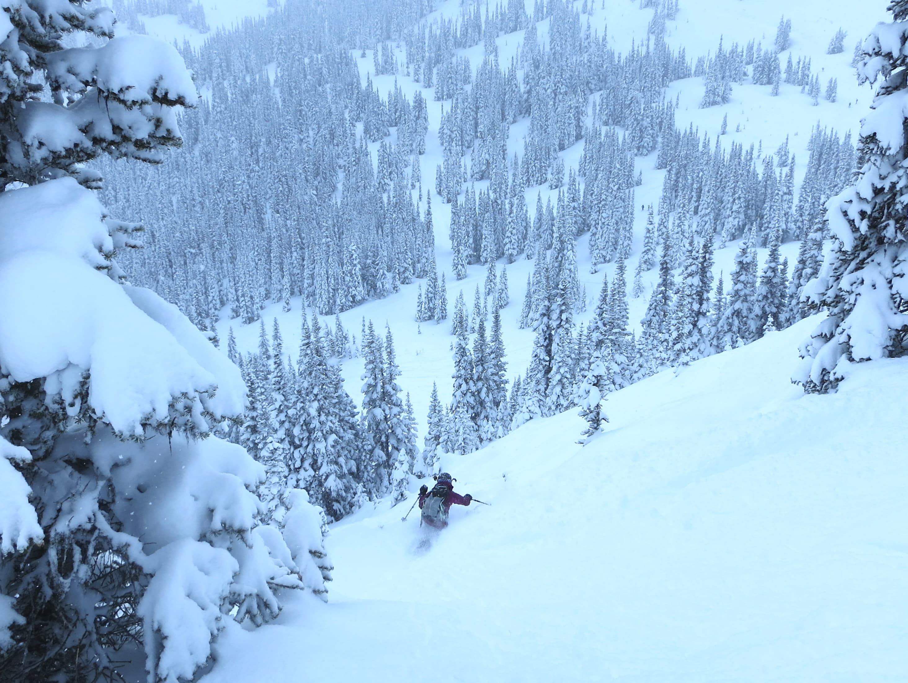
Deep powder in the mountains: the kind of days El Niño tilts the odds toward in the Sierra Nevada and Southern Rockies
Updated 21 October 2026: what NOAA's October outlook means
- El Niño Advisory still in place, and NOAA now says a "strong-to-very strong El Niño" is "likely through January-March 2027" (CPC ENSO Diagnostic Discussion, 8 October 2026). In September, NOAA's summary was a "greater than 90% chance of a very strong event during the Northern Hemisphere fall and winter 2026-27" (CPC ENSO Diagnostic Discussion, 10 September 2026). October's wording names a strong-to-very strong event and runs to January–March 2027.
- Niño-3.4 reached +2.1°C for the past month in the 8 October 2026 discussion, up from +1.8°C in the 10 September 2026 discussion.
- The chance of a historic event, stronger than every El Niño back to 1950 (+2.5°C or more for a 3-month RONI value): 54% for September–November, 83% for October–December and 70% for November–January (CPC, 8 October 2026). In the 10 September 2026 discussion, it was 75% for October–December.
- NOAA's next update is 12 November; we'll update this page that day.
Does El Niño mean more snow? It depends where you ski. NOAA's historical maps tilt California and the Southwest towards wetter winters, and western Canada and Japan towards warmer ones. They show nothing consistent for the Alps or the Northeast. That's why each region has its own section below.
Seasonal odds are not your week's forecast. Everything on this page is a historical tendency across a whole winter, not a prediction for any trip. Once your dates are close, a daily forecast outranks seasonal odds: Pow Alert ranks every resort we track by its 7-day snowfall forecast, refreshed every six hours from Open-Meteo data.
The regional sections draw on two NOAA sources: the US impacts article (NOAA Climate.gov, "United States El Niño Impacts", 12 June 2014) and NOAA's maps of typical El Niño patterns for December–February and June–August (NOAA Climate.gov, "Global impacts of El Niño and La Niña"). Both describe what has tended to happen in past El Niño winters. Neither is a forecast for this season. In NOAA's words, "'associated with' doesn't mean that all of these impacts happen during every El Niño episode."
What El Niño means for Whistler and BC
NOAA's December–February map marks a warm band across southern Alaska and western Canada, British Columbia included. It marks no wet or dry tendency for BC. South of the border, NOAA describes "a less-reliable dry signal in the Pacific Northwest and the northern Rockies" (NOAA Climate.gov, 2014). NOAA's material says nothing about BC snowfall in particular, so we don't either. Watch the forecast for Whistler Blackcomb and Revelstoke on Pow Alert as your dates approach.
What El Niño means for Colorado
NOAA says that over California and the Southwest, the link between El Niño and above-average precipitation "is weaker, and it depends significantly on the strength of the El Niño" (NOAA Climate.gov, 2014). NOAA's December–February map draws its wet area over California and the desert Southwest, and a cool-and-wet area from Texas to Florida. Colorado is not clearly inside either. This event is forecast to be strong to very strong (CPC, 8 October 2026), but NOAA gives no Colorado-specific outlook, and we won't invent one. For Telluride, Vail, Breckenridge and Winter Park, the 7-day forecast on Pow Alert is the better guide.
What El Niño means for Lake Tahoe and California
California sits inside the wet area on NOAA's December–February map. NOAA adds the caveat that over California and the Southwest the relationship "is weaker, and it depends significantly on the strength of the El Niño" (NOAA Climate.gov, 2014). This is a strong-to-very strong event (CPC, 8 October 2026), the case that caveat is about. Strength shifts the odds; it doesn't promise a big season, and the 2015–16 event discussed below is the reminder. Resorts: Palisades Tahoe, Heavenly, Kirkwood and Mammoth Mountain. Live forecasts are on Pow Alert.
What El Niño means for Utah and the Rockies
For Utah, NOAA's material is silent. The US impacts article doesn't mention Utah, and the December–February map leaves it unshaded. For the northern Rockies, NOAA describes "a less-reliable dry signal" (NOAA Climate.gov, 2014). That's a weak tendency in NOAA's own words, not a forecast. For Park City, Alta, Snowbird, Jackson Hole and Big Sky, use the daily forecast on Pow Alert.
What El Niño means for the Northeast
NOAA's material is silent here too. The US impacts article doesn't mention the Northeast, and NOAA's December–February map leaves it unshaded. We won't fill that gap with a guess. For Stowe, Killington, Sugarbush, Jay Peak and Sunday River, the 7-day forecast on Pow Alert is what to watch.
What El Niño means for Japan
NOAA's December–February map marks Japan as warm in El Niño winters. It marks no wet or dry tendency there. That is the extent of NOAA's guidance in the sources above. Our earlier analysis below discusses the Siberian airflow behind Japan's powder. For Niseko United, Hakuba Valley and Rusutsu, check Pow Alert closer to your dates.
What El Niño means for the Alps
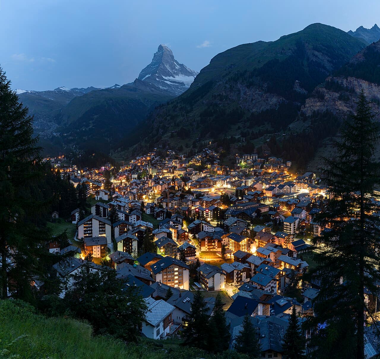
NOAA's December–February map shows no consistent El Niño tendency anywhere in Europe. Nothing in NOAA's October material points to a different Alpine winter in either direction, and we won't suggest one. Altitude and dates matter more than ENSO for Val Thorens, Zermatt, St Anton, Chamonix and Verbier; check Pow Alert as your dates approach.
What El Niño means for the Southern Hemisphere
The southern ski season runs June to August. NOAA's October outlook covers the event through January–March 2027 (CPC, 8 October 2026). It says nothing about El Niño during the 2027 southern winter. In past El Niño years, NOAA's June–August map marks a small wet area over central Chile, near Portillo and Valle Nevado. For the Australian and New Zealand ski areas (Thredbo, Perisher, Coronet Peak, Cardrona, Mt Hutt), the map is unclear, and we read no tendency into it. We'll revisit this section as NOAA's outlook extends into 2027.
Our analysis from 8 October 2026, kept as history
Everything below was written for NOAA's 8 October 2026 discussion and is kept as it was. The update above is the current summary. Where the two differ, the update above is newer.
NOAA's October 2026 forecast puts 83% odds on the strongest El Niño since at least 1950, with a 100% chance of a very strong event in October to December 2026 — the window the median forecast path also picks as the peak. For skiers, strong El Niño winters have historically produced above-average snowfall in the southern Rockies and California, though no forecast guarantees any single season's snow. Peak timing, and region-by-region predictions, below.
NOAA declared El Niño on June 11, 2026, and the Climate Prediction Center now has the event strengthening under an El Niño Advisory. Its 8 October 2026 discussion puts an 83% chance on a historic event in October to December 2026, defined as a 3-month RONI value of +2.5°C or more — a strength that would exceed every El Niño dating back to 1950 (CPC ENSO Diagnostic Discussion, 8 October 2026).
Every probability below carries a season and a threshold, because the same percentage means different things without both. The chance of a very strong event (RONI +2.0°C or more) runs 100% in September to November, 100% in October to December and 96% in November to January, then eases to 81% in December to February and 46% in January to March (Strength Probabilities, Oct 2026). The chance of El Niño conditions of any strength continuing through December to February is 100% (Probabilities, Oct 2026). Those two December-to-February numbers answer different questions: El Niño is effectively certain to still be running during the core of the ski season, while the odds it is still a very strong event by then are about four in five.
Two numbers to keep apart, because they are easy to run together. 83% is the chance of a historic event in October to December at the +2.5°C threshold, and 81% is the chance of a very strong event in December to February at the +2.0°C threshold. Different season, different threshold, different source document. In September both read 75%, and each was quoted as "a 75% chance" without saying which; a percentage quoted without its season and threshold is still unusable.
Read the decay, not a single headline. The "greater than 90%" figure in circulation is carried by the autumn seasons — 100%, 100% and 96% for SON, OND and NDJ — and does not describe the core of the northern ski season, where the very strong threshold falls to 81% and then 46%. These are probabilities, not certainties: this event sits on a warmer global baseline than any predecessor, and the nearest modern analog (2015–16) ran storm tracks materially further north than the historical composite predicted.
When this El Niño peaks: the median path
The question most seasonal coverage raises and then does not answer is when. The Climate Prediction Center's RONI outlook gives a median forecast path season by season, and it peaks in October to December 2026 at +2.74°C, then decays monotonically through the rest of the ski season and into spring.
| Season | Median RONI | Middle 70% of forecasts | Above +2.5°C (historic)? | Above +2.0°C (very strong)? |
|---|---|---|---|---|
| SON 2026 | +2.47°C | +2.29 to +2.65°C | no | yes |
| OND 2026 — peak | +2.74°C | +2.43 to +3.05°C | yes | yes |
| NDJ 2026–27 | +2.65°C | +2.24 to +3.06°C | yes | yes |
| DJF 2026–27 | +2.36°C | +1.87 to +2.85°C | no | yes |
| JFM 2027 | +1.90°C | +1.42 to +2.39°C | no | no |
| FMA 2027 | +1.33°C | +0.91 to +1.75°C | no | no |
| MAM 2027 | +0.83°C | +0.45 to +1.21°C | no | no |
| AMJ 2027 | +0.40°C | +0.01 to +0.79°C | no | no |
| MJJ 2027 | +0.03°C | −0.41 to +0.48°C | no | no |
Source: CPC RONI Outlook, October 2026. The middle-70% column is the 15th to 85th percentile of the forecast spread.
How to read the band, and how not to. The middle-70% column is a spread of forecasts, not a probability that an event occurs. It says where the middle seventy percent of model guidance sits for that season; it does not say there is a 70% chance of anything. This is the single most miscited part of the package after the colour-shading legend, and the distinction matters: the 83% and 100% figures elsewhere on this page are probabilities of crossing a named threshold, while +2.43 to +3.05°C is a range of plausible values. They are different kinds of number and cannot be compared to each other.
What this means for a ski trip. NOAA expects this El Niño to peak between October and December, before or at the very start of most North American ski seasons. It then eases: NOAA's middle forecast is still very strong (+2.0°C or more) from December to February, at +2.36°C, and just below that bar from January to March, at +1.90°C. That doesn't change when it matters for US skiing. NOAA says El Niño's influence on the U.S. "is strongest during the winter (January-March), but it lingers into the early spring" (NOAA Climate.gov, El Niño and La Niña FAQ). So expect the storm-track tilt described below to matter most from January to March. These are odds, not a snowfall schedule.
An east-based event, and what that tells you
The warming is not spread evenly across the Pacific. September's observed monthly values rise eastward from +2.1°C in Niño-3.4 to +3.0°C in Niño-3 and +3.9°C in Niño-1+2 off the coast of South America (CPC ENSO Diagnostic Discussion, 8 October 2026). That west-to-east gradient is the defining feature of this event.
These are measurements, not forecasts. The figures above are what the ocean did in September. Nothing in this section is a prediction, and the +3.9°C in Niño-1+2 in particular should not be read as a number the Pacific is heading toward — it is a number it has already reached in one specific region.
They are also not the same measure as the RONI figures above. Both are relative indices, each region's anomaly with the tropical mean subtracted (CPC ENSO Diagnostic Discussion, 8 October 2026, Fig. 2), but the monthly values are one observed month, while RONI on this page is a three-month average of Niño-3.4 and the table is a forecast of it. That is why September's observed +2.1°C in Niño-3.4 sits below the table's +2.74°C October-to-December median: one is what the ocean did, the other is where the forecast expects the three-month average to go. Every threshold on this page (very strong at +2.0°C, historic at +2.5°C) is defined on the three-month RONI, not on a single month's reading.
What the structure tells you. This is a textbook east-based El Niño, the canonical configuration rather than the central-Pacific "Modoki" type. It matters because the NOAA historical winter composites that every regional section below leans on are drawn predominantly from east-based events. The composite guidance on this page is being applied to an event of the structural type it was built from, which is the most favourable case for using it at all.
What it does not tell you. It is not a snowfall forecast, and it does not sharpen any regional number. Knowing the structure tells you which historical analogues are the relevant ones; it does not tell you how much snow falls on any mountain, in any week, at any resort. Read it as a reason the composite framing below is appropriate — not as an additional prediction layered on top of it. The 2015–16 caveat that runs through this page still applies in full, and 2015–16 was itself an east-based event that ran its storm tracks further north than the composite predicted.
2026/27 Snow Predictions: Region by Region
What follows are regional predictions in the only sense a seasonal outlook supports: NOAA's El Niño composites shift the odds across a whole season, they do not forecast totals for any resort or any week. Every region below is described as a tendency, and the 2015–16 caveat in the section above applies throughout.
Colorado and New Mexico
The El Niño storm track reaches this corridor via the subtropical trough and Gulf of Mexico moisture surges, and NOAA's El Niño winter composites show above-average precipitation odds across it. The signal is strongest in the south: NOAA's favoured corridor is southern Colorado and New Mexico rather than the state of Colorado as a whole, and ski hire in Telluride and where to stay in Taos Ski Valley sit inside it. Northern Colorado sits closer to the boundary and carries no clear signal in either direction. See Where the odds tilt up for the detail.
Utah: where the predictions say least
Utah is the honest gap in this outlook. NOAA's El Niño composites place the favoured storm track across the southern tier and the drier tendency across the Pacific Northwest and Northern Rockies, and Utah falls between the two without appearing clearly in either. That is not a prediction of an average season; it means the ENSO signal carries less information here than it does further south or further north, and local factors matter proportionally more.
California and Tahoe
California's mountains are among the primary El Niño beneficiaries in North America according to NOAA's historical winter composites, with the amplified subtropical jet channelling Pacific moisture directly into the Sierra Nevada, over where to stay in Mammoth Mountain, where to stay in Palisades Tahoe and where to stay in Heavenly. Strong events have historically produced some of the range's largest seasonal totals. The honest caveat sits in the record itself: 2015–16 reached comparable early-season strength and ran storm tracks further north than the composite predicted, delivering a mixed season at lower elevations.
Pacific Northwest
The Cascades sit in the zone where NOAA's El Niño composites are associated with drier-than-average odds for the season, alongside the Northern Rockies and Interior British Columbia. That is a statement about storm tracks, not about the mountains. Individual storms are not bound by a seasonal composite, and 2015–16 delivered pockets of unexpectedly good snow to exactly the regions the composite had tilted away from. Higher terrain and snowmaking narrow the gap.
Northeast US
Parts of the Northeast tend to see above-average precipitation odds during strong El Niño events, according to NOAA's historical composites. The qualifier matters more here than elsewhere: the region's winters turn on storm track and temperature at the same time, and an active southern jet can deliver precipitation that falls as rain at lower elevations. The El Niño signal for the Northeast is real but weaker and less consistent than the Sierra Nevada or southern Rockies signal.
Alps
The Alps are largely outside the El Niño influence zone. Altitude matters more than ENSO phase for European resorts, and nothing in NOAA's outlooks supports a specific Alpine prediction for 2026/27 in either direction. Anyone reading this as a reason to change European plans is reading more into it than the data carries. What decides a European leg is the usual list: altitude, dates, and where you base yourself, whether that is where to stay in Zell am See in Austria or ski hire in Peisey-Vallandry in France. The pass angle section covers how a European leg pairs with a North American El Niño trip.
Japan
Japan's powder depends on cold, dry Siberian airflow crossing the Sea of Japan and unloading on west-facing slopes, primarily December through February. Strong El Niño winters are historically associated with a weakening of that airflow, which tends to reduce powder frequency on Hokkaido and the northern Japanese Alps relative to a La Niña year. The Sea of Japan coast carries most of that exposure; the Pacific side draws less of its snow from the same mechanism. December is historically the most reliable window regardless of phase.
Southern Hemisphere
The 2027 Andes, Australia and New Zealand seasons open long after this event decays. See The global picture for the decay profile and why peak-strength figures do not carry across the equator.
What a strong El Niño usually does
El Niño warms the central and eastern tropical Pacific above the long-term average. That warmer ocean surface amplifies and southward-shifts the subtropical jet stream as it crosses the Pacific. According to NOAA's Climate Prediction Center, the resulting US winter pattern is characterized by an active subtropical jet that steers moisture-laden storm systems across the southern tier of the continental United States, producing drier-than-usual odds for the Northern Rockies and Pacific Northwest and warmer conditions across the northern US. The October outlook puts this event squarely in the category where that signal is most reliable: a 100% chance of a very strong event — a 3-month RONI value of +2.0°C or more — in October to December 2026 (Strength Probabilities, Oct 2026).
The same mechanism weakens the cold Siberian airflow that drives Japan's famous powder season, and shifts precipitation patterns across the Southern Hemisphere. It does not write each day's weather report; it changes the probability distribution of what winters look like, in aggregate, across a full season.
Where the odds tilt up
Sierra Nevada: California
California's mountains are among the primary El Niño beneficiaries in North America according to NOAA's historical winter composites. The amplified subtropical jet channels Pacific moisture directly into the Sierra, and strong events have historically produced some of the range's largest seasonal totals.
- Mammoth Mountain: high-summit terrain positioned in the heart of the Sierra Nevada. The honest caveat: the 2015–16 El Niño at comparable early-season strength ran storm tracks further north than the composite predicted and delivered a mixed season at lower elevations. Mammoth's higher terrain held better, which is worth noting when booking.
- Palisades Tahoe: Lake Tahoe's largest resort in our data (243km piste), with north-facing terrain above 8,000ft that accumulates and holds snow well when the jet delivers.
- Heavenly and Kirkwood: both in the Lake Tahoe basin. Kirkwood's high-bowl position at 7,800ft base makes it one of the most efficient snow accumulators in California during active Pacific storm cycles.
Southern Rockies: Colorado and New Mexico
The El Niño storm track extends into southern Colorado and New Mexico via the subtropical trough and Gulf of Mexico moisture surges. NOAA's El Niño winter composites show above-average precipitation odds across this corridor.
- Telluride: southwest Colorado positioning puts it directly in the path of subtropical moisture plumes. A base elevation of 8,725ft means precipitation arrives as snow across almost all of the mountain in most conditions. Honest caveat: individual storm timing varies even within a favorable seasonal pattern; early booking should be paired with conditions monitoring.
- Taos Ski Valley: receives both Pacific systems and Gulf of Mexico moisture surges under an active subtropical jet, with a high base elevation that favours snow over rain at almost all elevations. Taos is compact; dry spells show immediately. Watch conditions closer to your trip dates.
Where to manage expectations
These are outstanding mountains in a season where the probabilities tilt away from them; a statement about storm tracks, never about the resorts themselves or what they deliver.
Before the regional breakdown: the 2015–16 El Niño reached a strength comparable to the current forecast and was, at the time, the strongest event in the modern observational record. Its storm tracks ran materially further north than the NOAA composite predicted. Resorts in the Northern Rockies and Pacific Northwest that the composite associated with drier odds saw pockets of unexpectedly good snow. The historical signal is real; its precision is not.
Pacific Northwest: Cascades
Crystal Mountain is one of Washington's largest ski resorts, with 57 kilometres of piste across sustained steep terrain in the Cascades and reliable snowfall when Pacific systems track through the region. Mt Bachelor in Oregon offers extraordinary terrain variety and a snowmaking system among the strongest on the West Coast. Both sit in the zone where NOAA's El Niño composites are associated with drier-than-average odds for the season.
If you are booked for the Cascades: prioritize the higher-elevation terrain both mountains offer, check where it is snowing right now from November onwards, and keep your dates flexible where your itinerary allows. Individual storm systems are not bound by the seasonal composite, and both mountains have the altitude and snowmaking to deliver strong skiing when systems arrive.
Northern Rockies: Montana, Wyoming, Idaho
Jackson Hole is one of the most technically demanding mountains in North America. Rendezvous Bowl and the terrain above Corbet's Couloir are world-class in any season that builds enough base. Big Sky is one of the largest resorts by skiable area in the United States, serving ability levels from beginner to committed expert with terrain variety that few destinations can match. Both are in the Northern Rockies zone where El Niño composites show drier-than-average odds.
The practical guidance for readers already booked there: Jackson Hole's expert terrain at high elevation is more forgiving of a compressed season than a valley-floor resort would be. Big Sky's sheer scale means that whatever storms arrive are distributed across terrain that rarely feels thin. Watch conditions from early November; the Pow Alert is updated every six hours.
Interior British Columbia
Revelstoke has one of the most dramatic vertical drops in North America (5,620ft) and a position between the Selkirks and Monashees that sometimes captures moisture from directions the ENSO composite does not fully represent. El Niño is associated with warmer, drier odds for the BC Interior, but Revelstoke's geography means it can surprise the forecast in both directions.
Whistler Blackcomb is on the Coast Range rather than the interior and has snowmaking infrastructure among the most extensive in Canada, alongside 5,000ft of vertical that spans a wide range of elevations and exposures. The El Niño pattern tilts drier and warmer for coastal BC; Whistler's infrastructure and terrain variety mitigate that tilt more than most mountains could.
For any of these destinations: monitor conditions rather than locking trips in during the first weeks of the season, target higher-elevation terrain that holds snow longer, and use live snow conditions for data rather than generalizations. The 2015–16 precedent is worth repeating: a comparable-strength El Niño ran its storm tracks further north than any composite forecast. The historical tilt has been wrong before.
The pass angle
The frame that matters first: both the Epic Pass and the Ikon Pass have major resorts on both sides of the storm track. El Niño does not favor either pass. What it changes is which resorts within each pass are worth prioritizing this winter. This section is about itinerary sequencing inside a pass, not about which pass to buy.
If you hold an Epic Pass
The tilt-up resorts within Epic's North American network are in the Sierra and southern Colorado. Heavenly and Kirkwood in the Lake Tahoe basin, and Telluride in southwest Colorado, are the best-positioned El Niño-season options in the portfolio. The tilt-down exposures are Whistler Blackcomb and Stevens Pass, both exceptional mountains in the zone where the pattern tilts drier.
Sequencing suggestion: prioritize California and southern Colorado days for January to March, when NOAA says El Niño's influence on the U.S. is strongest (NOAA Climate.gov). Epic's European network (Verbier, Les Menuires, Courchevel, Val Thorens) is largely outside the El Niño influence zone, and altitude matters more than ENSO phase for those resorts; pairing a North American El Niño trip with a European leg is a strong 2026/27 play for Epic holders.
If you hold an Ikon Pass
The tilt-up resorts within Ikon's North American network are significant. Mammoth Mountain is among the most historically El Niño-responsive mountains in North America. Palisades Tahoe rounds out the Lake Tahoe cluster. Taos Ski Valley is the leading Ikon option in New Mexico. The tilt-down exposures within Ikon are notable: Jackson Hole, Big Sky, Crystal Mountain, Mt Bachelor, and Revelstoke are all in the manage-expectations zone.
Sequencing suggestion: prioritize California, and Mammoth in particular, for January to March, the months NOAA says El Niño's influence on the U.S. is strongest (NOAA Climate.gov). Treat that as odds, not a promise: NOAA also notes that over California "the relationship between El Niño and above-average precipitation is weaker, and it depends significantly on the strength of the El Niño" (NOAA Climate.gov, 2014), and the 2015–16 event above is the reminder. If your Ikon itinerary also includes Japan, read the section below.
For the full resort-by-pass breakdown and current pricing, see the ski passes page.
Decided where to go?
Build your itinerary with the trip planner.
The global picture
Japan: a generous read on the probability
Japan's powder reputation is built on cold, dry Siberian airflow that crosses the Sea of Japan and unloads on west-facing mountain slopes, primarily from December through February. Strong El Niño winters are historically associated with a weakening of that airflow, which tends to reduce powder frequency on Hokkaido and the northern Japanese Alps relative to a La Niña year. This is a probability shift observed across multiple strong El Niño events; it is not a forecast for any specific resort or snowfall total.
Niseko United and Hakuba Valley are exceptional destinations in any ENSO phase. Their terrain quality, mountain culture, and infrastructure are not functions of Pacific sea surface temperatures. What may shift is the frequency of the deepest powder days relative to a strong La Niña winter.
If you are booked for Japan in 2026/27: the December window is historically the most reliable for powder regardless of ENSO phase, and arriving early gives the best chance of catching the Siberian pattern before any El Niño suppression establishes. Conditions that fall short of a La Niña benchmark still rank among the best skiing most travelers will ever experience.
South America: looking ahead to 2027
This refers to the southern hemisphere ski season running June through October 2027, not the current 2026 season already underway.
Strong El Niño winters are historically associated with heavier snowfall in the central Andes, the zone that includes Portillo and Valle Nevado in Chile. This is one of the clearest El Niño precipitation signals in the Southern Hemisphere.
Timing matters here more than peak strength. The median forecast path peaks at +2.74°C in October to December 2026 and decays steadily from there: +1.90°C by January to March 2027, +1.33°C by February to April, and +0.83°C by March to May (CPC RONI Outlook, October 2026). It is below the very strong threshold of +2.0°C from January to March onward, and close to neutral by the end of that run. The event described above peaks during the northern winter and has decayed well below very strong before the Andean lifts open in June 2027. Treat the historical Andes signal as a reason to watch the 2027 season as it approaches, not as a peak-strength forecast that carries across the equator six months later.
See the South America ski guide for resort options, flight planning, and what to expect across the Andes range.
Australia and New Zealand: 2027 watch item
El Niño is historically associated with mixed and sometimes reduced precipitation across parts of Australia's alpine region and New Zealand's South Island; we will update this section as the 2027 southern hemisphere outlook becomes clearer through late 2026.
How this forecast will change
NOAA releases an updated ENSO Diagnostic Discussion on the second Thursday of each month, and the Climate Prediction Center updates its seasonal probability forecasts on the same schedule. We update this page within 48 hours of each NOAA release. This page reflects the 8 October 2026 discussion, with the regional summary above added on 21 October 2026. NOAA's next update is 12 November 2026; we'll update this page that day.
The key numbers to watch, each of which needs a season and a threshold attached to mean anything: the probability of the very strong threshold (RONI +2.0°C or more) at 100% for October to December 2026, easing to 81% for December to February and 46% for January to March; the odds of a historic event (RONI +2.5°C or more) at 83% for October to December; the probability of El Niño conditions of any strength, at 100% for December to February; the monthly Niño index values and the east-west contrast between them; and NOAA's seasonal outlook maps for the western US. These are the primary inputs that would change the regional guidance above.
For conditions during the season, current snow conditions across every tracked resort are ranked by 7-day snowfall forecast and refreshed every six hours from Open-Meteo data.
For the full 2026/27 planning picture (pass economics, resort picks by region, and the season calendar), see Where to Ski 2026/27. The deeper ENSO mechanism, covering what La Niña and neutral years look like and how to read NOAA's seasonal outlook, is in El Niño vs La Niña: How Climate Patterns Affect Your Ski Trip.
 Article
El Niño vs La Niña: How Climate Patterns Affect Your Ski Trip
ENSO cycles — El Niño, La Niña, and neutral years — shift the jet stream and change which ski regions get buried in powder and which get left dry. Here is how each phase affects snowfall by region and how to use that information when planning your trip.
ArticleWhere to Ski 2026/27: Best Resorts, Pass Picks & Snow
El Niño is reshaping 2026/27 snowfall. Best resort picks across Europe, Rockies, Japan & the Andes, with Epic/Ikon pass analysis and snow forecast.
 Article
South America Ski Resorts: The Complete 2026 Guide to Skiing in Chile & Argentina
9 ski resorts in Chile and Argentina compared by season, terrain, and cost. Skiing in South America starts from around $1,800 per week including flights from the US.
More Guides